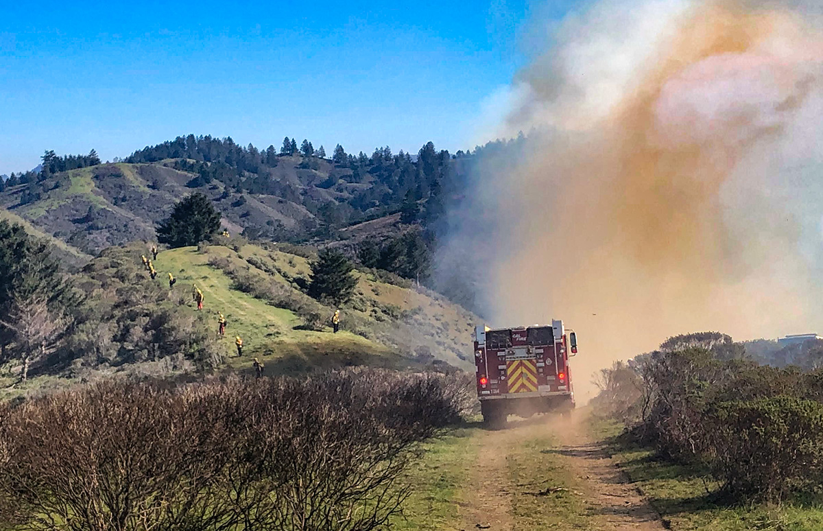
On Friday February, 11th, 2022, we conducted our second prescribed burn on TomKat Ranch, in partnership with Cal Fire CZU, as part of our 10 year Prescribed Burn program.
How We Monitor Land Systems Change After Prescribed Fires

By: Bill Milliot
 On Friday, February 11th, 2022, we conducted our second prescribed burn on TomKat Ranch, in partnership with Cal Fire CZU, as part of our 10-year Prescribed Burn program. Our goal with using fire is to quickly and naturally reduce fuels loads on areas overgrown with woody vegetation, thereby opening the landscape enough for continued fuel load maintenance via adaptive grazing of cattle, sheep, and goats that create multiple benefits along the way.
Utilizing regenerative land management tools, such as adaptive grazing and browsing of livestock, to manage fuel sources reduces the risk of large, explosive wildfires and the need for other tools, such as machinery or chemical treatments. Besides reducing fuel loads directly, properly planned grazing helps hydrate the landscape by leaving living roots intact, breaking up compacted ‘cap soil’ through hoof impact and creating thatch cover by ungrazed trampled material that protects soil from raindrop strikes and sheet-flow runoff aiding water infiltration and bolstering landscape resiliency to fire and drought conditions.
Most California landscapes, even the coastal ranges, evolved with fire. Long, dry seasons and occasional dry lightning events meant vegetation would burn at regular intervals, sometimes sweeping unimpeded over a landscape and burning out woody vegetation. Prior to human-induced fire, it is likely that this natural burning helped grasses to flourish which in turn attracted grazing herds of megafauna whose natural regenerative impacts benefited soil and grasses and kept brush from encroaching. In this way, plants, wildlife, and soil evolved to benefit from fire and fuel loads were regularly reduced, preventing the high-intensity and soil-damaging fires California has been experiencing in the twenty-first century. One Yale-led study concluded that the loss of the ancient megafauna grazing species triggered a dramatic increase in fire activity in the world’s grasslands.
Today, where human habitation presses up against wildlands (what’s referred to as the ‘wildland-urban interface’), suppression has become the dominant approach for dealing with wildland fire. Combined with decades of overall fire suppression efforts that interfered with natural cycles, and lack of impact from grazing or browsing herds, woody vegetation has expanded into what would otherwise be mixed or open grasslands creating new fuel loads in coastal ranges and California ecosystems.
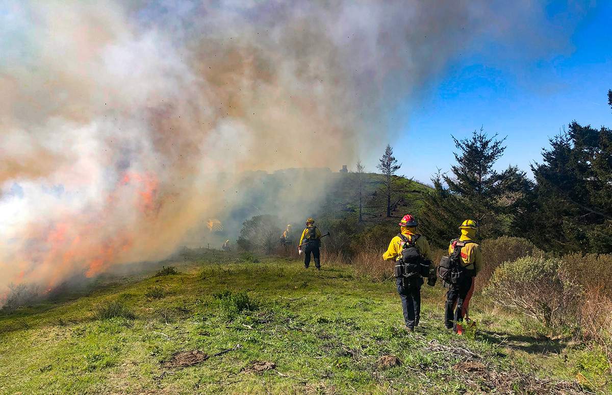
This is where controlled burns followed by a well-timed grazing plan come into play. Thanks to our relationship with Cal Fire CZU we have been able to safely deploy and begin to study the effectiveness of combining these management tools.
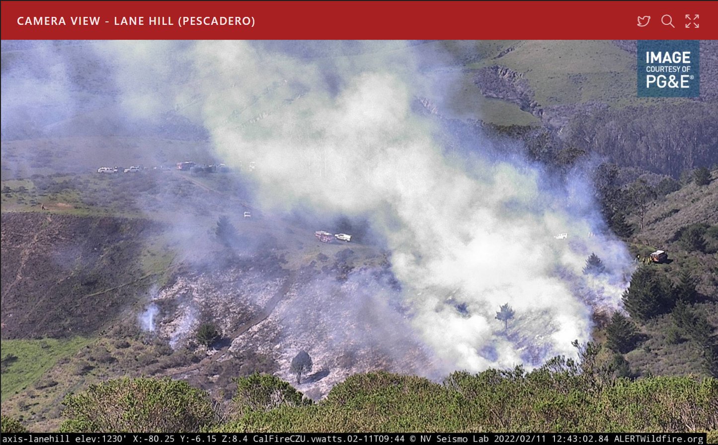
What impact will fires have on our landscape over time? One way we plan to find out is by monitoring the ongoing results by documenting the area with Google Earth Pro and other photographic tools. Below are examples of the images we’ve captured and our thoughts on what we are observing to date.
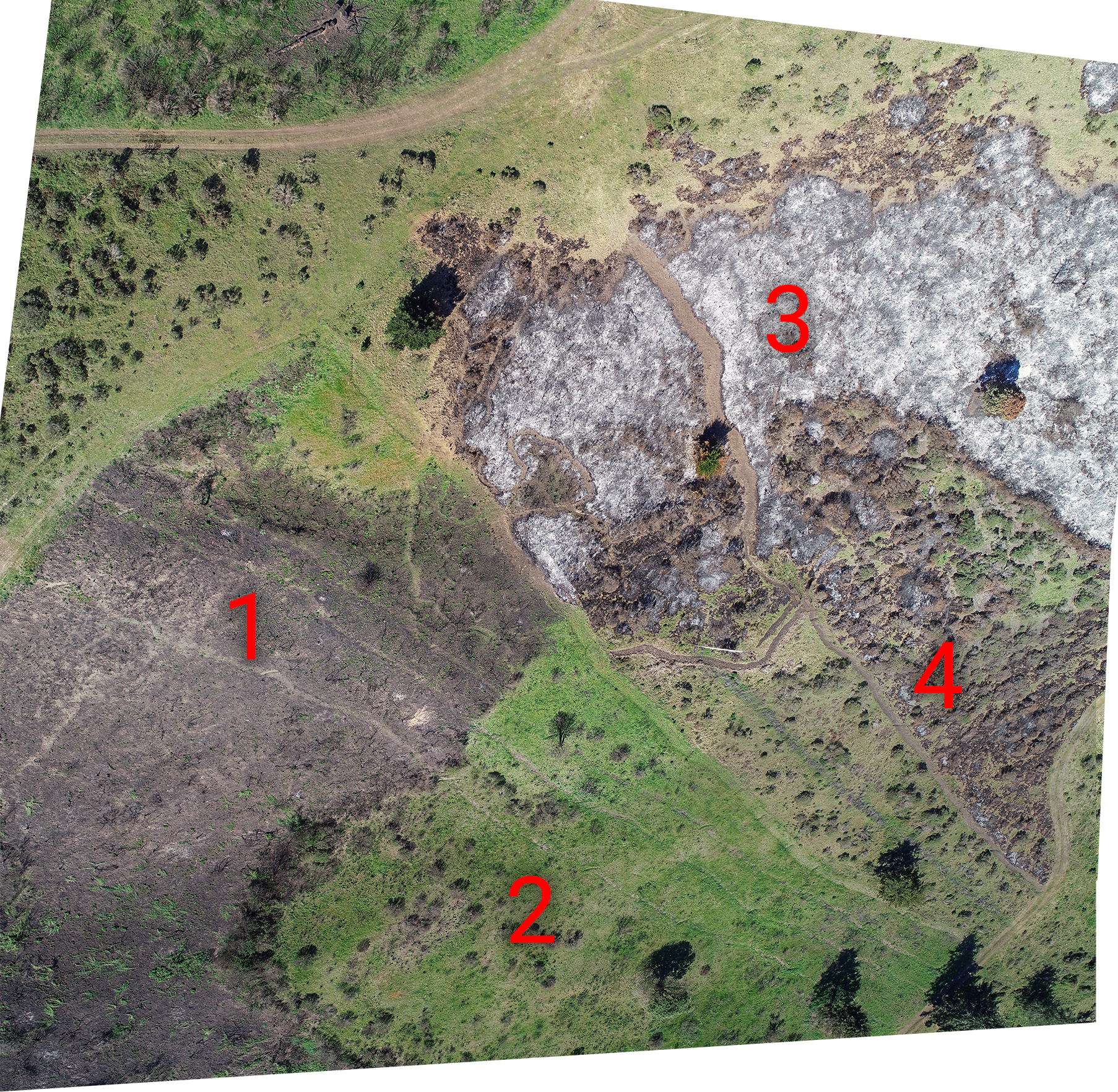
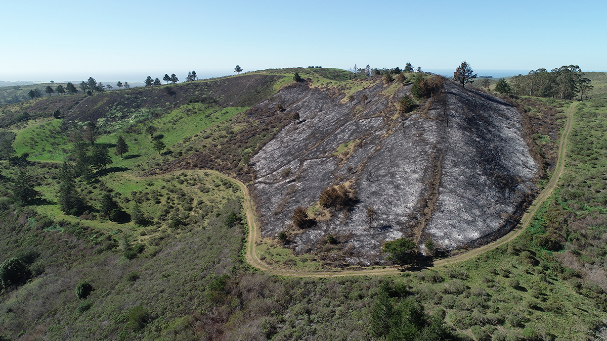
This picture represents three compiled images after the firing operations on October 1 and February 11 looking down-slope (from top-left to bottom-right). The composite image shows two distinct stages and two different levels of fire intensity. The path in the center running from the upper-left to the bottom-right is a hand-cleared control line dividing the two burns. Several other control lines, cleared by Cal Fire teams using hand tools in 2021 as part of annual training exercises, are also visible in the photo.
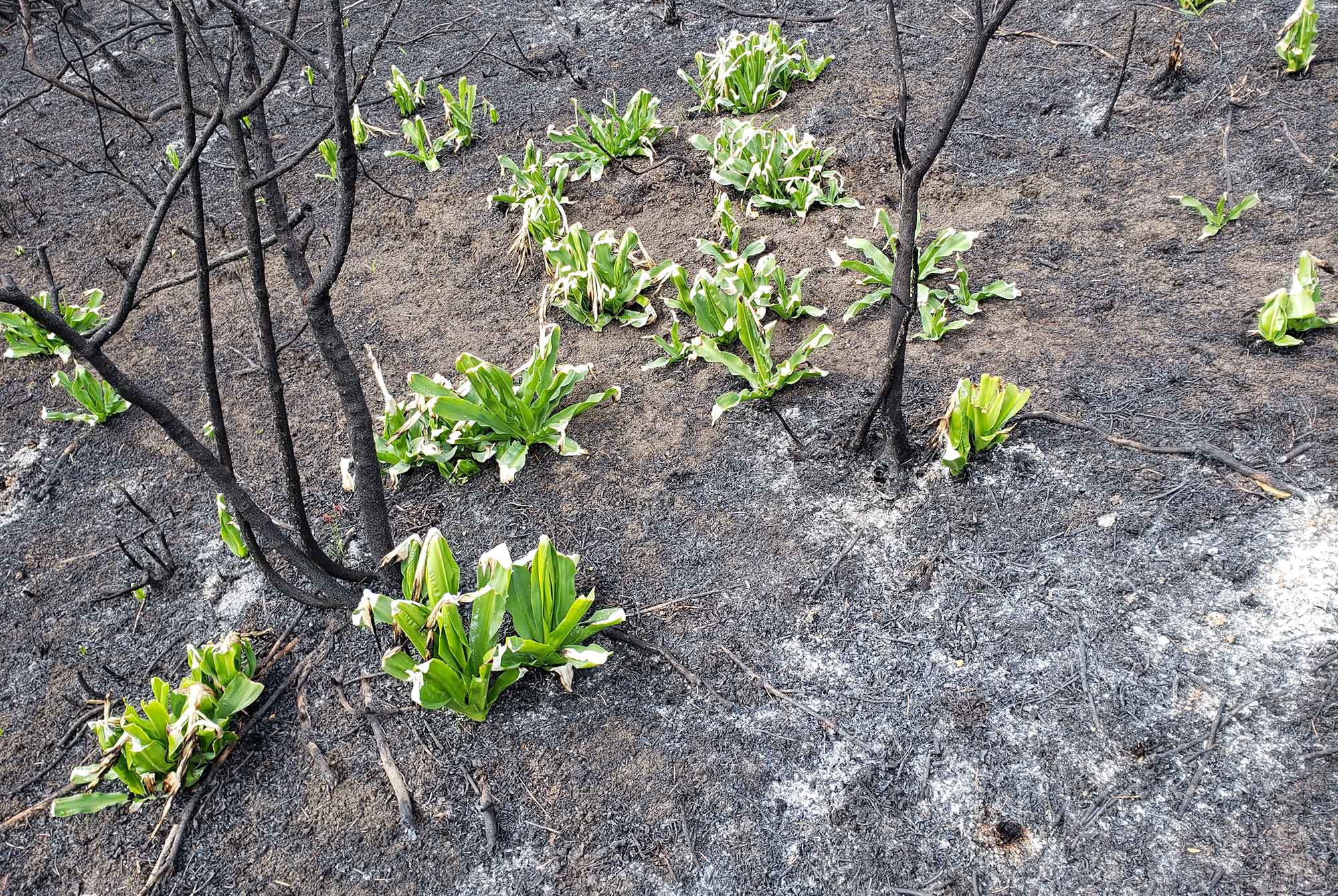
1) The dark gray area in the left lower quadrant of the photo is the burn scar from the initial prescribed fire on October 1, 2021. The conditions were dry and warm and the area dense with coyote brush, bramble, and poison oak. The near-complete eradication of brush in this area was likely the result of a high-intensity burn associated with the steep incline and low vegetation moisture levels resulting in a higher degree of fire severity. Even so, a few plant species such as the native Marah Fabacea (Wild Cucumber) and Artemisia Californica are already repopulating the area (green patches in the very lower-left corner). We also noticed infiltration was still occurring as water from heavy rains in the late Fall seemed to soak into the ground, a positive indication that the fire wasn’t so intense that it caused hydrophobic or water-repellent soil conditions.
2) The bottom-center (green triangle shape) also burned on October 1st, contained less woody vegetation, and because it was somewhat level, the fire was not as intense. This area was intentionally left ungrazed per the request of Cal Fire from the start of the rainy season to accumulate sufficient fine fuels to carry the fire between the brush. The bright green shows how grasses recovered quickly after the early rains, likely due to higher moisture levels and the living grass roots in the soil.
3) In the upper-right of the image, the white speckled area is the recent February burn. This area was also densely vegetated with scrub and bramble and on a steep slope. It burned intensely, as is evident from the accumulation of white ash. That it burned so thoroughly in winter, even after the heavy rains of early autumn (over 21” since October 1, 2021), suggests that the brush had unseasonably low moisture levels—a manifestation of the dry conditions associated with the ongoing drought.
4) Below and to the right of the control line is an area of less dense brush which was grazed in January and was also ignited during the February 11 fire. The lack of grass (due to grazing in late January 2022), the higher moisture content of the brush due to its location in a drainage area, and the overall lesser incline limited the fire’s potential, restricting it to patches of grass and bramble between the brush.
In the end, we wound up with a mosaic landscape of unburned, lightly burned, and intensely burned areas achieving one of our goals at the start of the program.
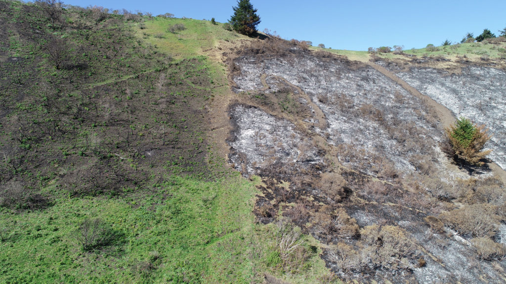
This photo is of the same area as above but from near ground level looking straight up the fire control line noted in the composite image. Note the four distinct burn areas of the October and February fires.
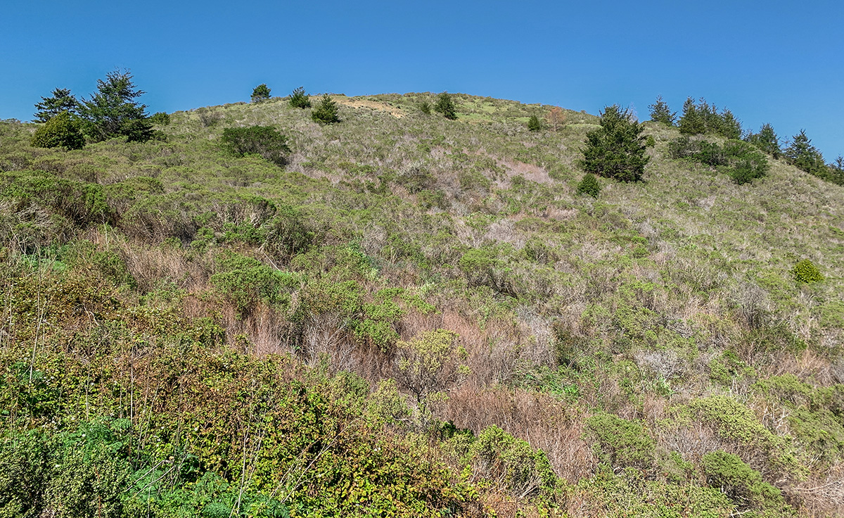
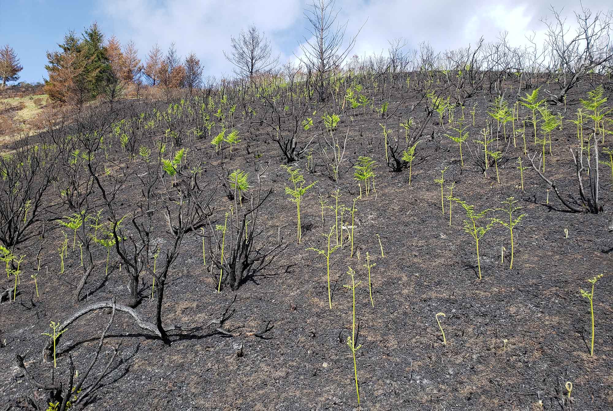
This image is of a heavily vegetated hillside across from the recent burn. It represents the density and types of vegetation that existed in parts of the burn units prior to the firing. The area is inaccessible by foot and would likely burn intensely during a wildfire. The ongoing drought and the fuel load density make it a threat for high-intensity fire even during winter.
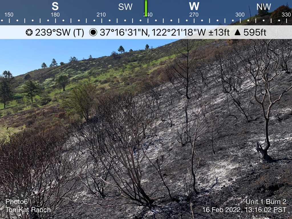
This image—from a land survey app (hat-tip to Ariel Greenwood)—will be incorporated into a Google Earth KMZ file for later comparison as the area re-vegetates. This level of char is a clear indication of the fire’s intensity due to slope, vegetation density, and abnormally low fuel moisture levels.
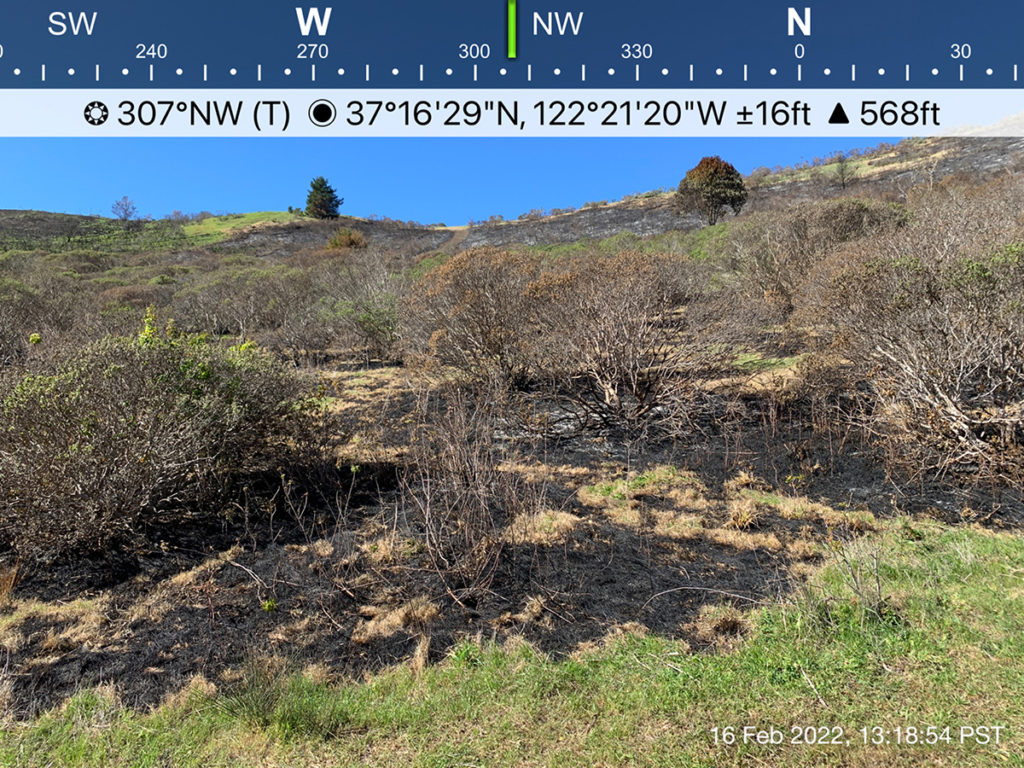
This image was also taken with the survey app. It shows how less vegetation reduced the fire’s ability to grow and intensify. In this area, it only consumed grasses and ground litter and left brush mainly intact. The challenge going forward is to regularly graze the area, ensuring it doesn’t become a high-level fuel source.
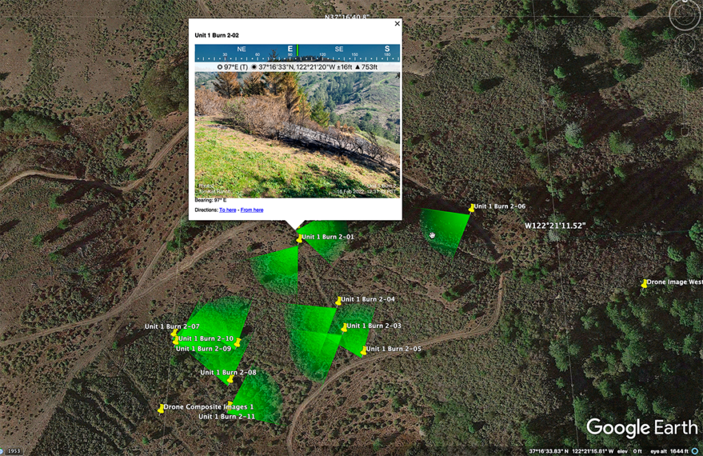
This image is a screengrab from Google Earth showing how different image files can be used to monitor changes over time. Green triangles indicate the directional viewsheds saved as KMZ files from the survey app.
View the slide show to see more images from February burn.
We will continue monitoring and actively managing these sites with our grazing herds. Our hope is to preserve these areas as fire breaks for the foreseeable future using cattle and goats. Lowering available fuel loads can slow and even stop wildfires from spreading as well as create areas where firefighting efforts can prove more effective. Stay tuned for more information and updates.
We would like to thank the following agencies, organizations, and people for being a part of this successful prescribed burn, including the Amah Mutsun Stewards for joining us in a practice that embodies the customs of generations who managed these landscapes before us:
- CAL FIRE, San Mateo County Fire Department
- San Mateo Consolidated Fire Department
- California National Guard out of CAL FIRE Santa Clara Unit
- Amah Mutsun Stewards
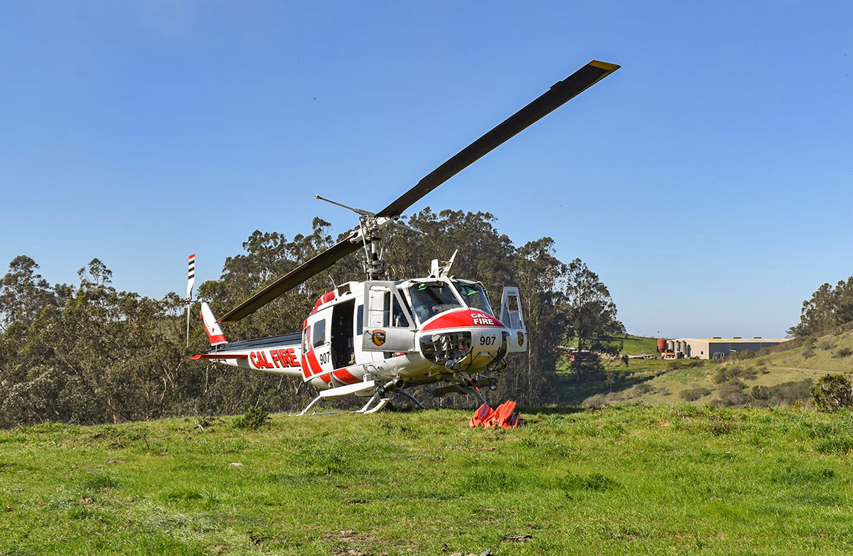
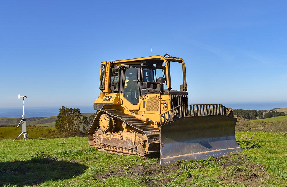
- Copter 907 and CAL FIRE Dozer 1741
- Ben Lomond Conservation Camp
- Kings Mountain Fire Department
More information on fire preparedness:
Cal Fire Twitter feed:
The Amah Mutsun native stewards are gaining experience lighting the #TomKatBurn #CaWx #California https://t.co/lc148P3kyH
— CAL FIRE CZU (@CALFIRECZU) February 11, 2022